
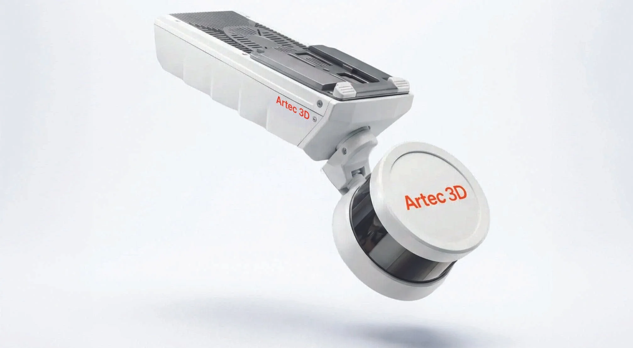
Introducing the Artec Jet!
We are very excited to announce the official launch of our latest 3D scanner, Artec Jet!
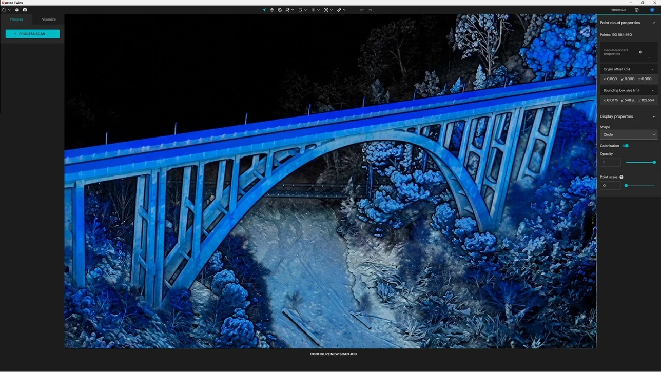
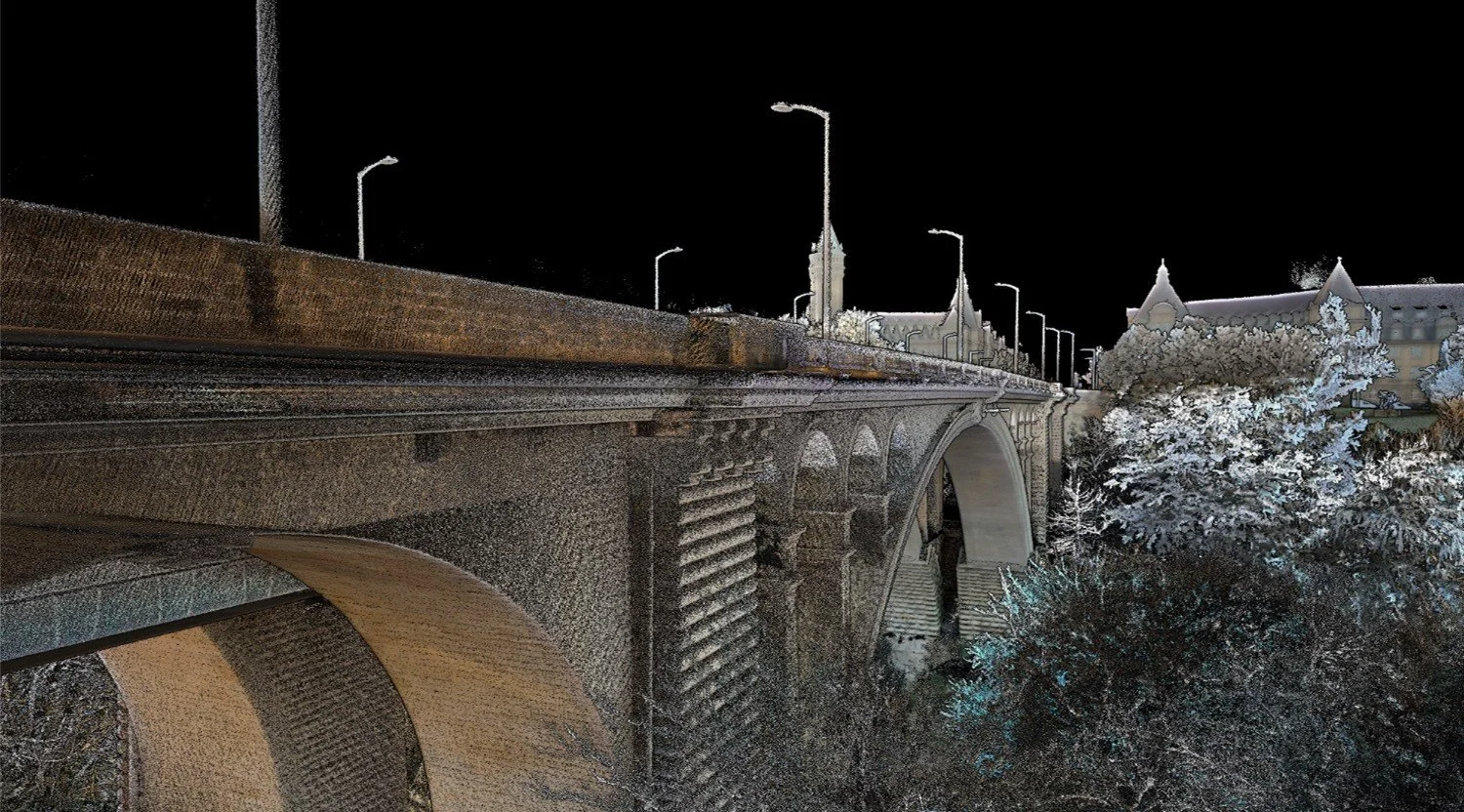
From real scenes to digital twins in minutes!
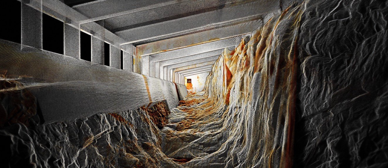
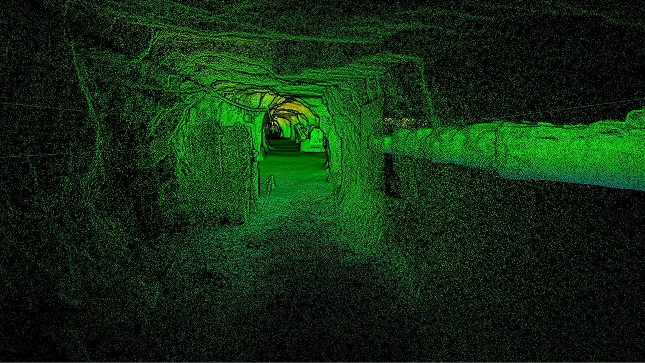
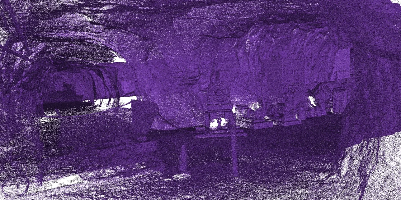
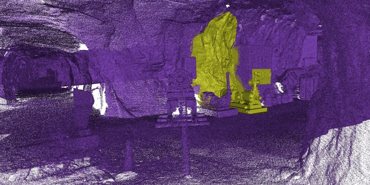
Artec Jet is a high-speed mobile LiDAR mapping system that combines SLAM-based positioning and AI-powered autonomy to capture sites, facilities & infrastructure, even in GPS-denied environments – in minutes rather than hours, with survey-grade accuracy.
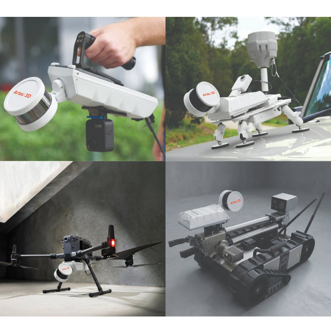
Capture by hand, mount to a backpack, robot, vehicle, or drone. Artec Jet offers multiple different deployment modes in a single compact, lightweight device. Choose the option that best suits your application, whether it be wide area surveying, or underground and facility mapping.
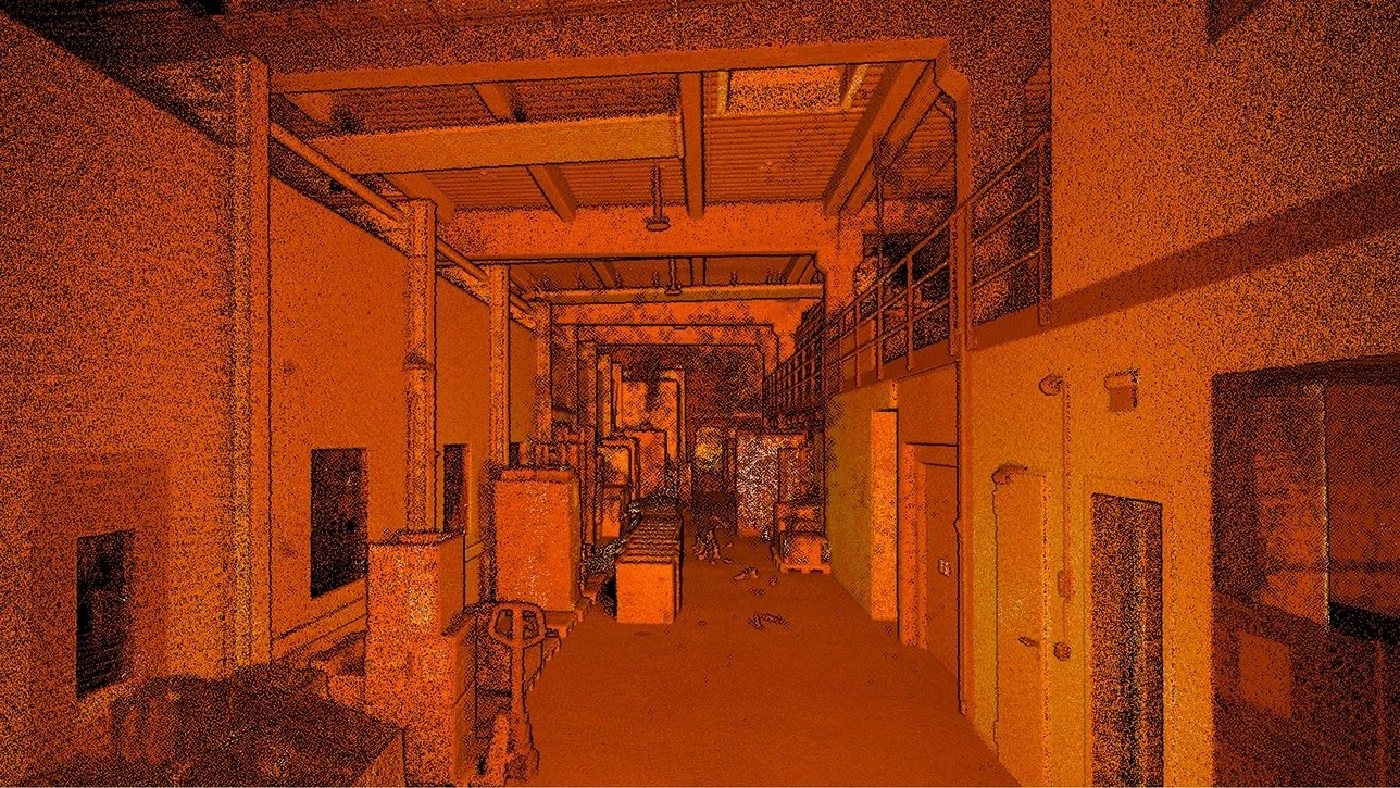
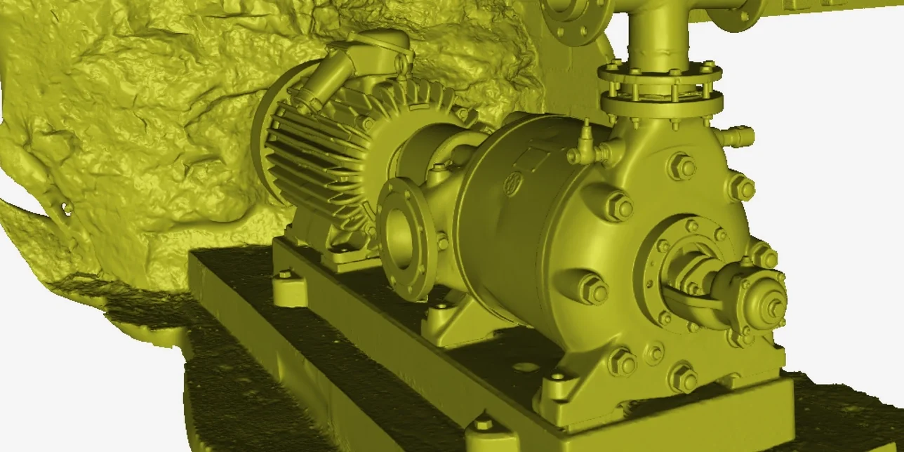
Within the mining, construction, defense, public safety, and civil infrastructure industries, Artec Jet captures accurate data, ideal for digital twins, as-built documentation, volumetric measurement, clash detection, and inspection.
Together with Artec Ray II and Leo, scanners well-suited to large-object and fine-detail capture, Artec Jet enables a complete pipeline for digitizing everything from sites to components.
Capture at speed with survey-grade accuracy
Artec Jet’s high-resolution LiDAR sensors and industry-leading SLAM technology deliver detailed point clouds at high speed – for reliable data capture over wider areas in less time.
Whether you’re capturing large machinery, vertical shafts, factories, open-air sites, or road networks, Artec Jet scales effortlessly to match the scope and complexity of your project. Access environments that are difficult to reach or dangerous to enter — and scan critical assets with a single device built for the toughest conditions.
Industries
Industrial plants: Freely traverse and capture confined spaces in industrial plants, refineries, and processing facilities to carry out predictive maintenance that reduces downtime.
Oil & gas: Scan refineries, offshore platforms, and pipelines. Drone-map flare stacks and elevated structures without scaffolding, or monitor pipeline corrosion over time.
Mining: Drone-map stopes, shafts, and headings too dangerous for humans. Scan routes with vehicles or carry out mine mapping on foot.
Civil infrastructure: Track the condition of bridges, tunnels, and dams with autonomous scanning and acquire repeatable, georeferenced data for preventive maintenance.
Public safety: Digitize disaster scenes and structural collapses with drones while keeping first responders at a safe distance.
AEC: Capture as-built documentation of buildings, bridges, and infrastructure. Walk sites with a backpack, fly drones under bridges, scan road networks by vehicle.
Defense & security: Map tunnels, buildings, and terrain in GPS-denied environments with autonomous drones, or use ground robots to capture real-time tactical 3D data.
From site wide to individual component scans in one ecosystem
Artec Jet expands the Artec 3D ecosystem to cover everything from entire sites to individual components, in one seamless workflow that delivers detail exactly where it’s needed, accurately and efficiently.
For more information visit: Artec Jet